Phone sky app · October 2026
I live in intown Atlanta. On a clear night I can pick out a couple dozen stars, and every sky app I tried still drew thousands of them. The screen never matched the sky.
Stars does the usual job: hold your phone up and it labels the stars, planets, Moon and space station. But it only shows what you can actually see from where you’re standing, tonight. It’s one of my favorite things I’ve built.
Made for a phone held up at the sky. I use it in Chrome on Android, and it works on iPhone too. On a computer, drag the sky around.
A map of the sky’s glow
The hard part is knowing how bright your sky is. So I built a worldwide map of it from NASA’s satellite pictures of night lights, NASA’s haze records and the shape of the land (a ridge can hide a town’s glow). National Park Service sky cameras set the brightness scale, and hand-held sky meters agree with it to about a tenth of a magnitude in Europe and North America.
The first test
The first real test was a moonless night in Gatlinburg, Tennessee, and the app showed way too many stars. Matched to the sky, the faintest stars overhead were about magnitude 3.4 (bigger numbers are fainter). The model expected about 5: it assumed a trained observer, and thought I could see stars four times fainter than I could.
That started a rebuild, beginning with an eye curve fitted to more than 26,000 Globe at Night reports from regular people. Back in Atlanta, at the bus stop before sunrise, the default was pretty much spot on.
Tuned to your eyes
Eyes differ, and no map knows about the streetlight next door. So the app can check with four to eight stars, asking if you can see each one, and it remembers the result for that spot. It also sends anonymous sky reports, with the location rounded to about 5 km, so its first guess gets better for everyone.
Lines between stars you can see
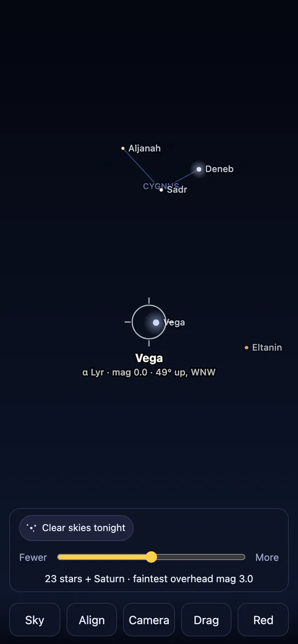
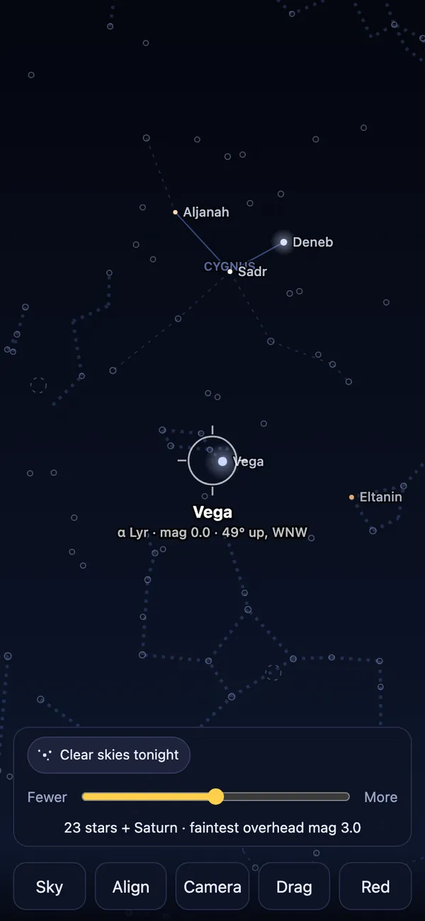
Constellation lines only join stars you can actually see. From Midtown, Cygnus shrinks to three stars and two lines, and Vega sits on its own. Turn on “show what’s hiding” and the rest comes back as faint dotted lines, so you know what’s up there.
Star notes and tonight
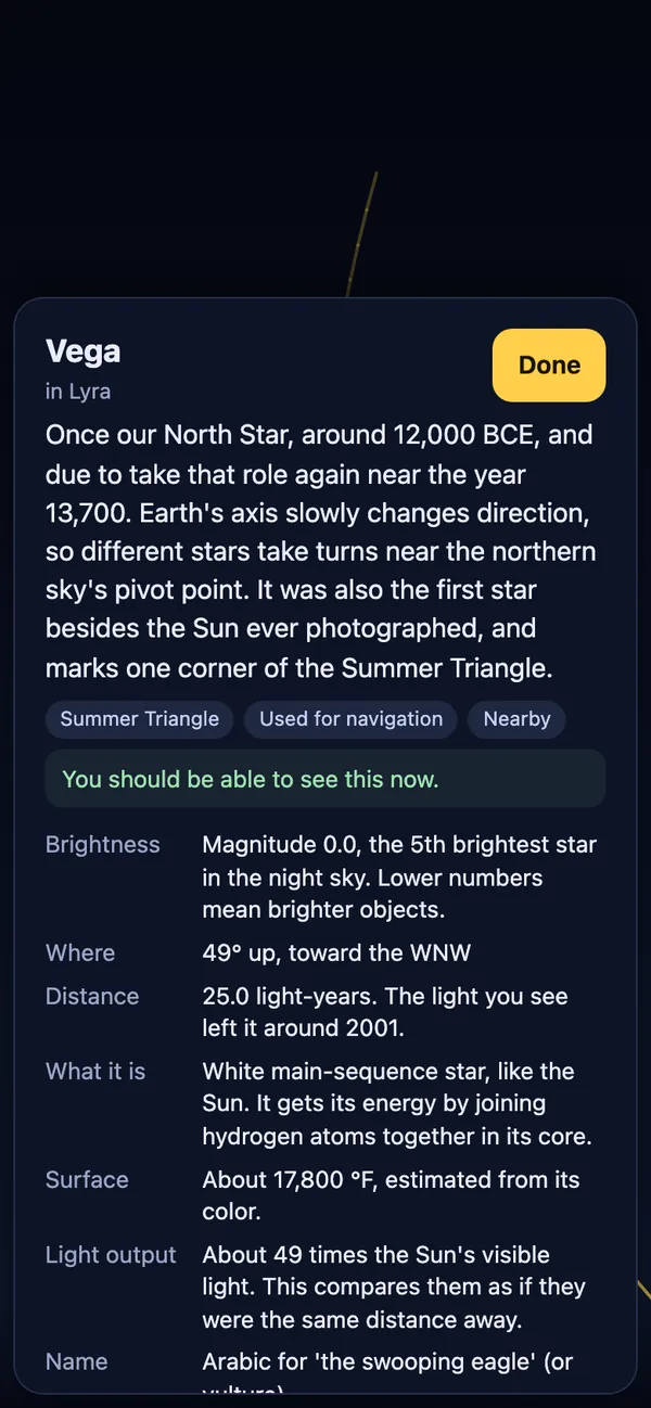
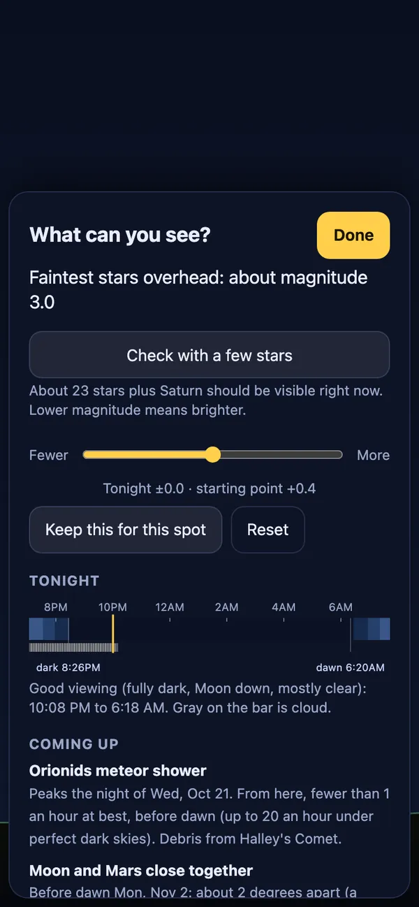
Tap a star for a short note in plain English. The 1,000 brightest have one, written from Wikipedia and fact-checked. Chips say when it gets fully dark, what the Moon is doing and when the space station passes over, with an alert before passes you can see. Tap anything to see its path across tonight’s sky.
How it’s built
- Plain TypeScript and canvas, no framework. Installed, it works offline.
- Positions checked against Skyfield, an independent astronomy library, to about 20 arcseconds.
- Stars from the HYG catalog, constellation lines from d3-celestial, space station orbits from CelesTrak.
- The sky map is 44,170 tiles covering land from 57° S to 77° N.
What’s next
Stars is a working title. Before it goes public it needs a real name, a privacy page and a page of credits. The longer-term plan is to share the sky checks openly, as citizen science.